 |
| Add caption |
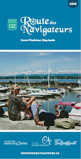
It was the title of the colourful brochure that caught my
eye, “Route Des Navigateurs”. I had been
wandering around a visitor information office in downtown Montreal, perusing racks
of tourist pamphlets, looking for inspiration. My wife,
Maureen and I had just spent several glorious days exploring the wonders and
attractions of Quebec’s largest city. Now, it was time to move on. Our next stop was Quebec City, then on to the Gaspe. The quickest and most expedient route
was the multi-laned Trans-Canada highway but, that wasn’t our style. This blog is about routes less travelled and that’s what I hoped to find when I
picked up the pamphlet.
The title, roughly translated meant, “Route of the
Navigators” or “Route of the Explorers”. In my mind’s eye, this evoked images of great French navigators like Samuel de Champlain or Jacque Cartier. I felt an
immediate connection. After all, weren’t they and modern day
RV’ers kindred spirits, motivated by the same desire to see what lay over the
horizon or around the next bend? Naturally, I picked it up.
The brochure was beautifully crafted with gorgeous colour
pictures, detailed maps, lists of attractions and activities plus compelling
commentaries.
“Ride the waves and take the time to explore the many
historical, cultural and maritime sites in our beautiful regions.
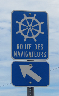
Well-indicated with easily recognizable signs, the Route des Navigateurs mainly
follows Route 132 on over 470 kilometres, leading you through the tourist areas
of Centre-du-Québec, Chaudière-Appalaches, and Bas-Saint-Laurent, from
Baie-du-Febvre to Sainte-Luce.
To
follow the Route des Navigateurs is to enjoy the splendour of innumerable
panoramas, the generous gift of the St. Lawrence and its islands. Since we know
you won’t want to miss a thing, we have carefully indicated each site using
sail-shaped symbols. So cast off on a voyage of discovery and search for
unforgettable treasures!”
 |
| "Route Des Navigateurs" Map (Click to Enlarge) |
Wow, this route seemed to have it all, pastoral farmland,
quaint villages, rugged coastlines, stunning views, attractions to see,
activities to do, all set against the azure blue waters of the mighty St
Lawrence. By the time I had finished reading the brochure, I was hooked. With a
little convincing, so was Maureen. We had to drive this route.
Following Quebec Highway 132 - Mostly
As the brochure explained, Route Des Navigateurs was about
500 km long and followed Quebec Highway 132 along the south shore of the St
Lawrence River with the occasional side trip through villages, settlements and
other areas of interest bypassed by the main highway. To assist modern day
navigators, the route was marked with distinctive road signs. What I didn’t
realize at the time was, the route had been intended for cyclists, not RV’ers. As
a result, some of the side trips to scenic vistas or historic sites were a little “tight” for a large rig while some
of the recommended stops did not have adequate parking for anything larger than a compact car. Overall, it was not a
big issue except for one spot, which I'll mention later on.
Cheap Date!
The route began at the intersection of Highways 255 and 132
near the village of Baie-du-Febvre,
about halfway between Montreal and Quebec City. Driving up from Montreal, we
reached the intersection around 12:00 PM. On one corner was a large gravelled parking
lot, the perfect place to stop for lunch. Off to one side was a food cart
complete with tables, chairs and awnings. Our plan was to eat in the trailer so
we parked as far away as possible, wanting not to interfere with their business
and feeling just a little guilty for not eating there. To assuage my
conscience, I wandered over to the cart with the intention of buying something.
When I saw their menu, advertising two dollar hot dogs and one dollar chips,
onion rings and drinks, I quickly revised our lunch plans. After all, we were simply following the
advice provided by the brochure:
“In
the Centre-du-Québec region, beautiful landscapes and interesting stops along
the St. Lawrence River invite you to take a moment to relax or, even better, to
take the time to enjoy a picnic treating yourself to fresh local products
purchased along the way.”
While hot dogs and onion rings were probably not what
the brochure writer had in mind when he suggested, “… treating yourself to
fresh local products …”, it certainly was a treat and an inexpensive one at
that. I can’t remember the last time my wife and I dined out for less that
$10.00.
From Baie-du-Febvre To Quebec City
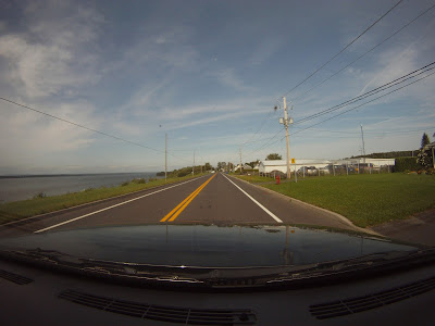
From Baie-du-Febvre, the Route Des Navigateurs followed Highway
132 along the south shore of the St Lawrence River with only one or two side
trips. For the most part, the highway was smooth and wide with a decent sized
cycle paths on both sides. That may be why the route was very popular with
cyclists. Winding through the countryside, it followed the twists and turns of
the St Lawrence shoreline.
 |
| Looking Across The St Lawrence River Towards Trois Riviere |
Thankfully, there were enough open spaces so we could see the river, the river traffic and the settlements, which dotted the
shoreline. The landscape was a mix of rural and urban that reminded me of the
Fraser River around the Maple Ridge, Mission Area. While we did pass some beautiful
old stone homes, heritage buildings and quaint communities, the area was far
more developed then I had expected and seemed to lack the picturesque, historic
vibe that I had hoped to find.
 |
| Quebec City KOA |
By the end of the day, we had reached our destination,
the Quebec City KOA campground, which was actually located on the western edge
of the city of Levis. Quebec City was across the river. We chose this park
because, among other things, it advertised a shuttle service to the historic
old town section of Quebec City. I had heard horror stories about the parking
situation around this area so, a shuttle seemed like the perfect solution. Maureen
and I spent a couple of wonderful days wandering the streets, shops, visiting historic
landmarks and enjoying the promenades of this historic city.
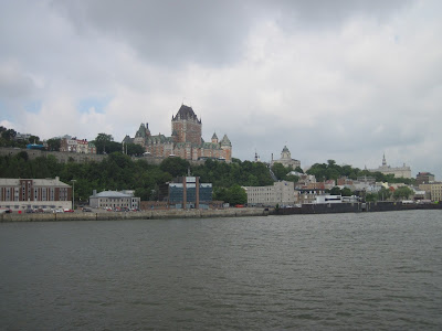 |
| Historic Quebec City |
 |
Swapping Exploration Stories With Jacque Cartier In Old Town, Quebec City
|
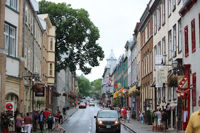 |
| Downtown - Upper Town, Quebec City |
With our Quebec City visit over, we continued on our way. The
plan was to keep following the Route Des Navigateurs, which ran through the
city of Levis. Instead of following Highway 132 however, the route took a
deviation down through the old part of town. Much like old town Quebec City,
the streets of old town Levis were narrow, congested and difficult to navigate.
After a couple of near disasters trying to maneuver through the narrow streets,
I abandoned the route and beat a hasty retreat back to Highway 132. Heart
stopping, hair-raising experiences were not part of our travel plans.
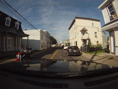 |
| The Narrow Streets of Levi |
On the eastern edge of the city, the Route Des Navigateurs once
again rejoined Highway 132. From there, we gradually left the city behind and rejoined
the countryside. Past Levis, the landscape took on a more rural, pastoral feel.
There seemed to be fewer people, less development and more agriculture then before.
It was the type of landscape I had hoped to find.
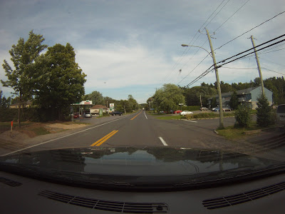
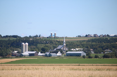
The route passed through several picturesque villages with
narrow streets, heritage style stone or brick houses and of course, a large
Catholic church. Some communities were so small, they consisted of little more
than the church surrounded by a few dwellings while others boasted a small
downtown area with a store, post office, restaurant or two and perhaps even a
gas station. A couple also featured a boutique hotel, (known as an “Auberg” in
French) overlooking the St Lawrence.
It was tempting to stop and explore but, finding a parking
spot large enough for a truck and trailer in these quaint surroundings was
“problematic” to say the least. Also problematic was trying to navigate through
some of them.
Many of the houses and
other buildings crowded the edge of the road. Some appeared so close that a
person standing on a porch could reach out and “high-five” the passanger of a
passing vehicle. It definitely required an extra measure of caution.
 |
| Narrow Village Streets |
As we proceeded northeast, the landscape around us gradually
changed. Along the shores of the St Lawrence, the marshy areas, common before
Quebec City now gave way to a rocky coastline with the occasional sand beach. The
river had become wider as well, so wide that the far shore was barely visible. Offshore, a number of rocky islands could
be seen. To landward, the Appalachian Mountains, which were barely
visible on the southern horizon before Levis, now drew closer to the
river’s edge. Nevertheless, as we rolled along Highway 132, the landscape ahead
of us was a beautiful tableau of shimmering blue water on our left and
peaceful, pastoral farmland on our right. In places, the highway ran along high
cliffs, providing breathtaking views of the river, numerous islands and marine
traffic.
 |
| Looking Across The St Lawrence River |
The first large community after Levis was the city of
Riviere-Du-Loup. Sandwiched between the St Lawrence River on one side and hills
to the other, the city had evolved along a long, narrow strip of flat land in
between. Many travellers may know Riviere-Du-Loup as the jumping off point for
the Maritimes, for this was where the TransCanada Highway turns south and east towards New Brunswick.
After Riviere-Du-Loup, the Route Des Navigateurs headed
inland for a bit, winding through pasture lands, cultivated fields, and the
occasional wood lot.
A few kilometers
past the Parc National Du Bic, one of the few parks along the south shore of
the St Lawrence River, the highway rejoined the river. Even though the name
seemed to indicate that it was a national park, it’s actual administered by the
Quebec government. Regardless, the park was well known for its hiking trails, nesting
colonies of seabirds, rare plants and seals who enjoy basking in the sun along
its shoreline. It also seemed to be a popular destination for many of the
cyclists, given the number we pasted along the way.
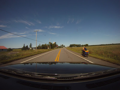 |
| Popular Cycle Route |
Not far past the park was the city of
Rimouski, our destination for the night. We were lucky enough to find a spot at
a nice motel and RV park combination just off Highway 132 called Camping and
Motel de I’Anse. Their full service sites were on a bench about 200 ft. above
the highway overlooking the St Lawrence River. The views of the river at sunset
were breath-taking.
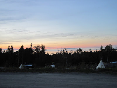 |
| Sunset on the St Lawrence |
With a population of around 50,000, Rimouski was the largest
city east of Quebec City on the St Lawrence River. Forestry was still significant,
but tourism has grown in importance, thanks not only to the neighboring Parc
National Du Bic but other nearby attractions as well such as the Pointe-au-Pere
Historic Maritime Site. On a peninsula, just outside of town were 3 marine
attractions. The first was the Empress of Ireland Museum, which told the story
of the Empress of Ireland, a passenger ship that sank not far from Rimouski
with the loss of 1,012 lives. The second was the Pointe-au-Pere Lighthouse
National Historic Site featuring the second highest lighthouse in Canada with 128
steps to the top (ask me how I know). The third was the submarine, HMCS
Onondaga, once part of the Canadian Navy, now on display for the general
public. In addition to the attractions, the site also offered some unserviced
RV spots.
 |
| Pointe-au-Pere Lighthouse - Second Highest in Canada |
 |
| Pointe-au-Pere Lighthouse - View from the Top: Parking Lot and Camping Area |
 |
| HMCS Onondaga |
One thing we hadn’t noticed as we made our way along the St
Lawrence River were seafood restaurants. Up to Rimouski, the waters of the St
Lawrence had been more fresh than salt. After that, the salt water began to
dominate and with it came the fish. Not long after leaving Rimouski, we came
across a very “kitschy” seafood restaurant called, “Capitaine Homard” or “Captain
Lobster” in English. With cut-out figures in front and a myriad of fishing
items dangling from the ceiling inside, it might have been considered a little
“over the top” were it not for the food which was excellent and the ocean view
which was fabulous. Their specialty was lobster but their menu contained a wide
variety of other seafood dishes. When I asked if the lobster was local, I was
told that while there were a few in the area, the season had long since closed.
The crustacean on my wife’s plate had come from New Brunswick. In addition to the restaurant, there was also an RV park
next door with some sites right on the water. Mighty handy for those who love
their lobster.
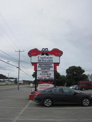 |
| Capitaine Homard |
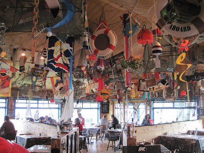 |
| "Over The Top" Ceiling Decorations |
 |
| The Restaurant May Be “Kitschy” But The Lobster Was Delicious |
With full tummies, we hit the road again for the final few
kilometers of our route. Up ahead lay the village of Stainte-Luce and the end
of the Route Des Navigateurs. In many ways, Stainte-Luce was a fitting place to
end the route. It was a beautiful, charming village built along a long,
crescent shaped beach, one of many such picturesque settlements along our path.
Overall, the route had been a delight to drive, tight spots not withstanding.
The quaint villages, the rugged shoreline, the pastoral farmland, the
picturesque vistas, the beautiful St Lawrence had been amazing and through it
all, the Route Des Navigateurs had been our faithful our guide on this most
wonderful Route Less Travelled.
 |
| The Village of Stainte-Luce |
 |
| End of the Route |
Resource List:








No comments:
Post a Comment